The Ring of Kerry is a famously spectacular loop of road that winds between the Atlantic Ocean and the mountains in the Iveragh Peninsula, Ireland.

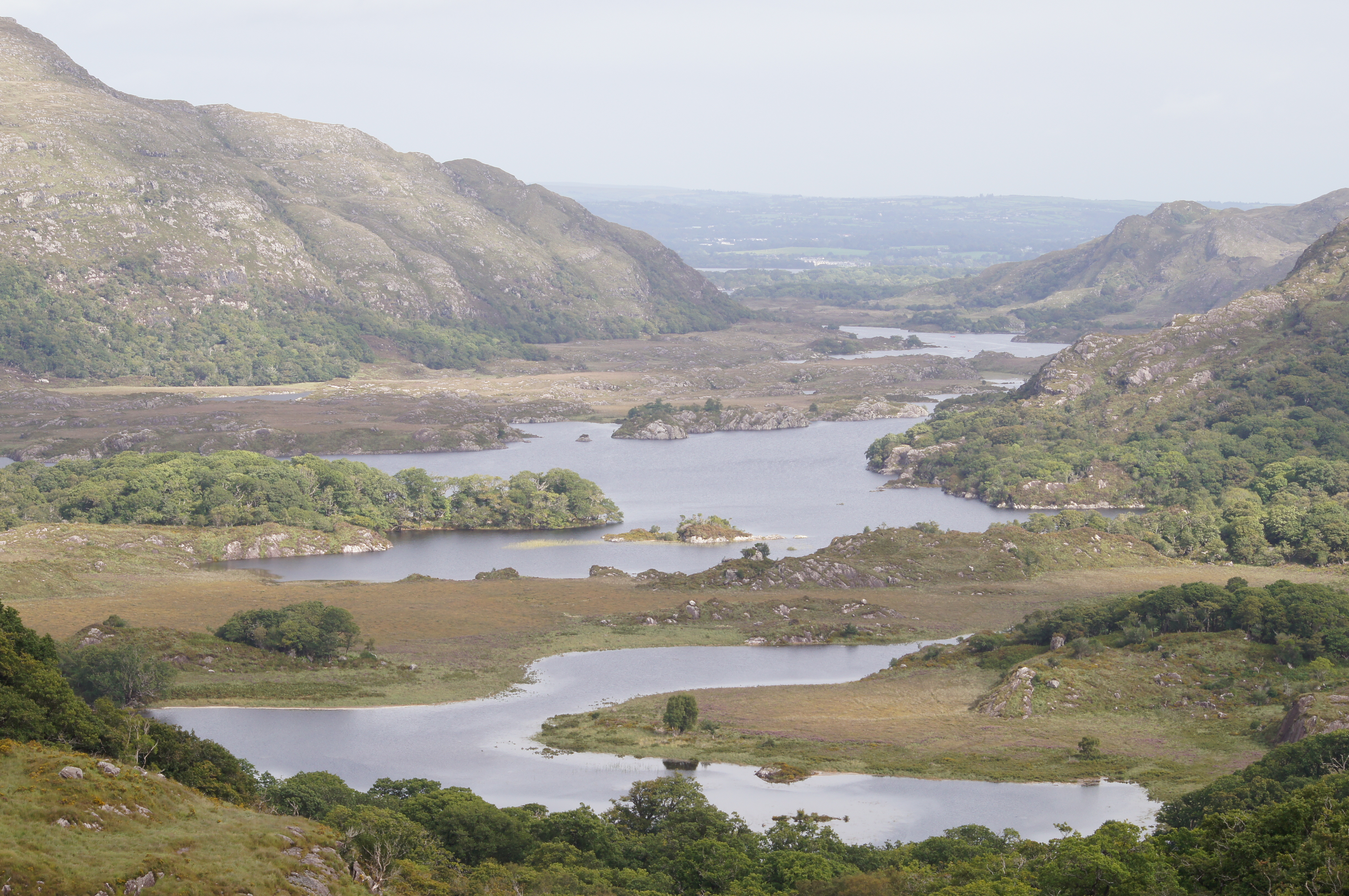
Spectacular Ladies View
We spent four days in the nearby Killarney Lakes area. This was a good decision – when we first arrived the weather was unseasonably rainy and cloudy, but over the next few days it improved and we were able to explore the Ring of Kerry in very different conditions.
Depending on the time of day and the weather, the scenery changes dramatically. It is really worth being on the road at “golden hour” (just after sunrise or before sunset) and taking ample time to pull over and take photos.
Superb photo opportunities can be found all along the loop. Our favourite lookouts were at Ladies’ View, at Moll’s Gap, beside the Killarney Lakes, and on the roadside edges on the inland hillsides between Moll’s Gap and the village of Sneem.
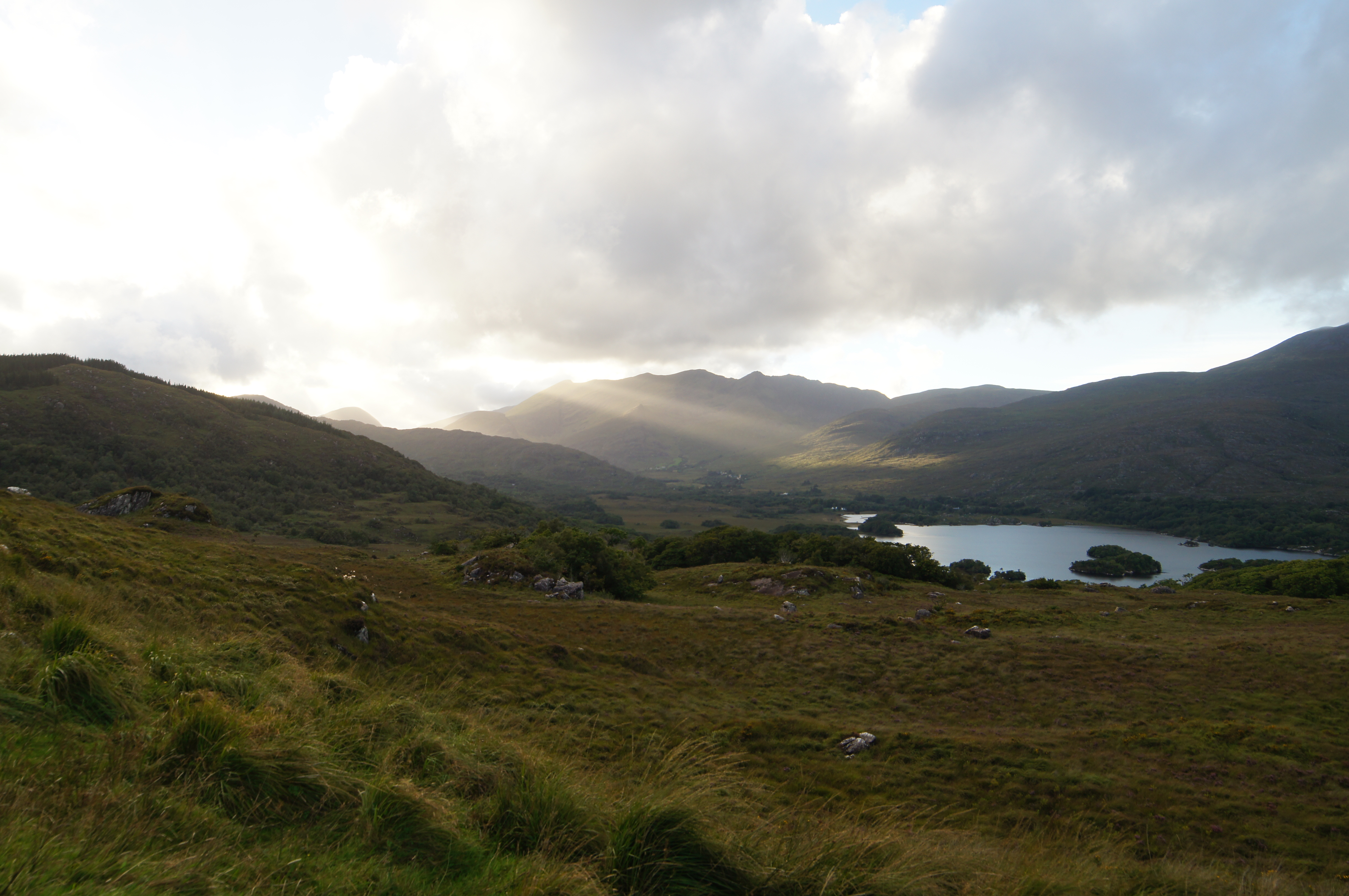
Ladies View, near dusk
Each day we packed a lunch and snacks. When we were hungry we pulled over wherever we could safely park. It was enjoyable eating a picnic lunch on the edge of the cliffs overlooking the deep valleys, which are dotted with stone walls and sheep.
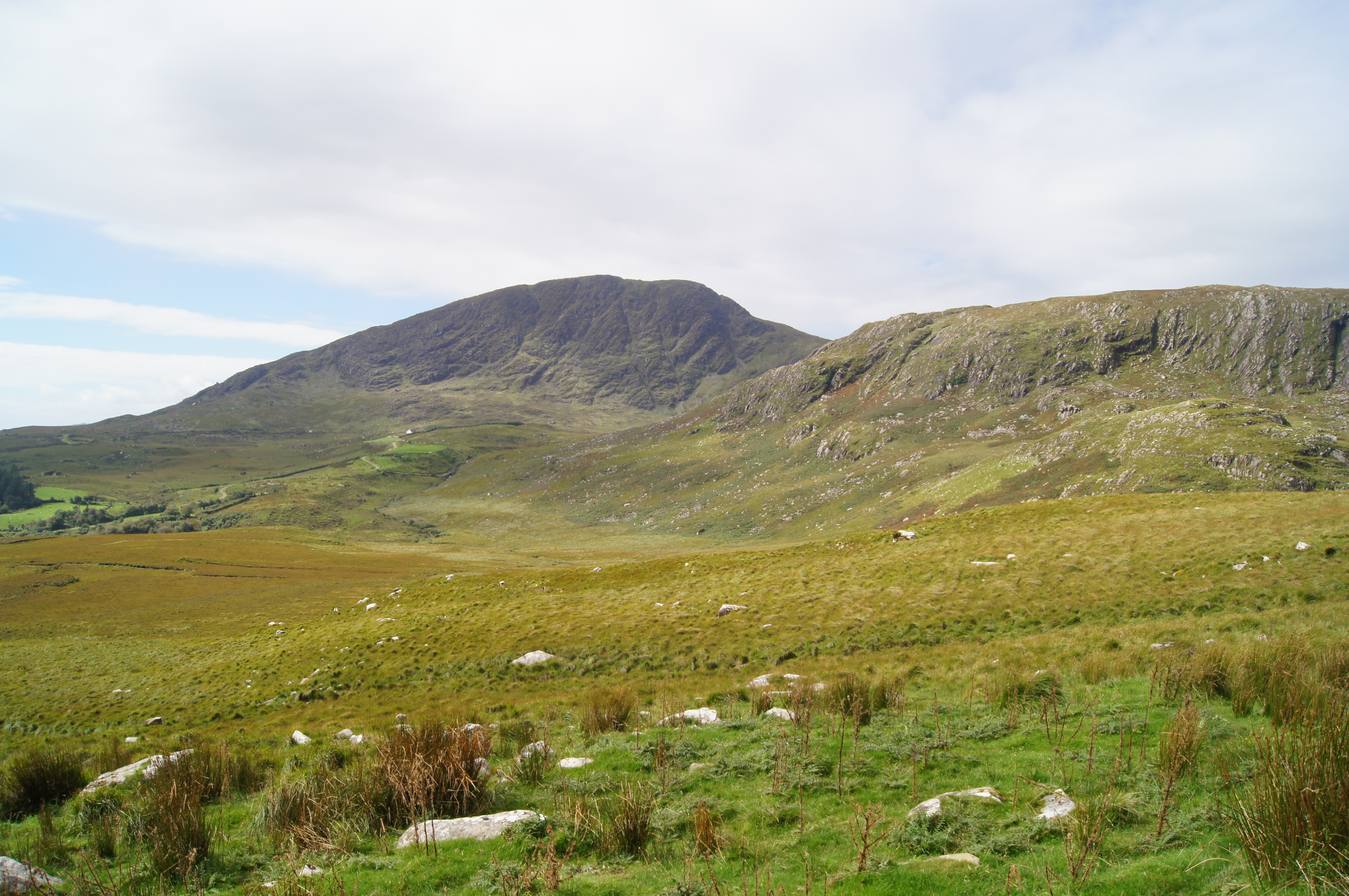
Past Moll’s Gap
Driving the Ring of Kerry
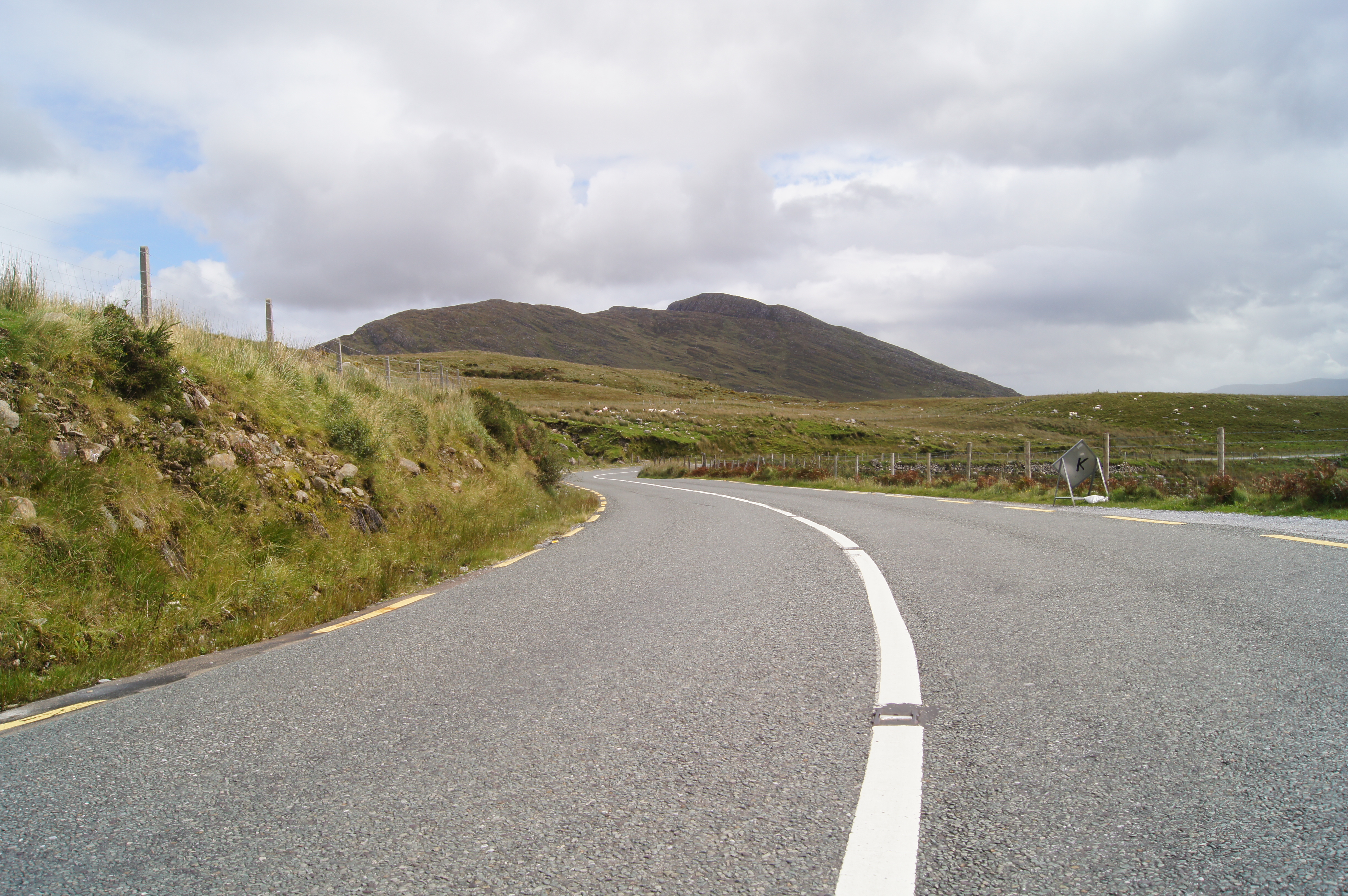
Driving around the Ring of Kerry requires close attention at all times.
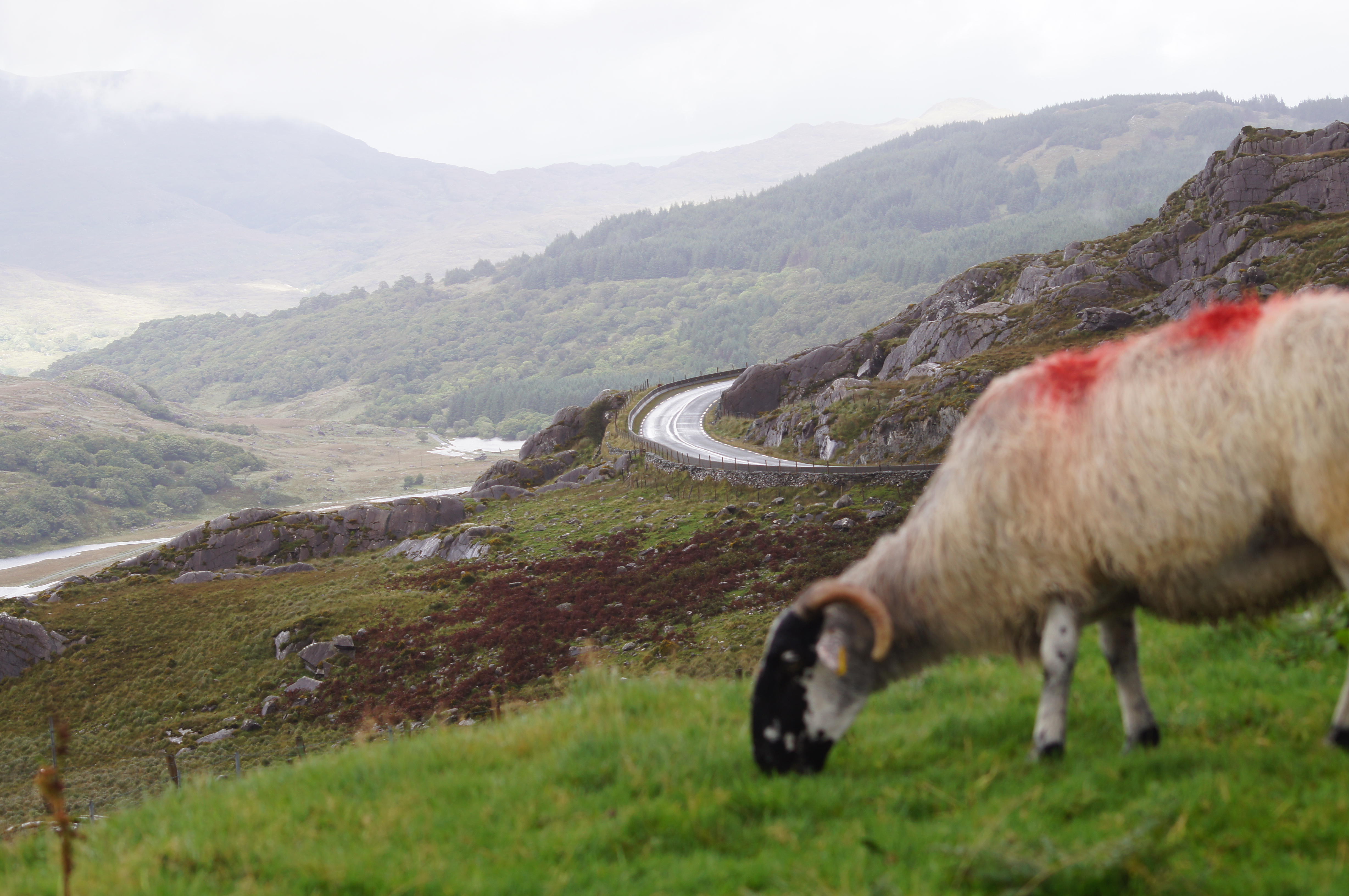
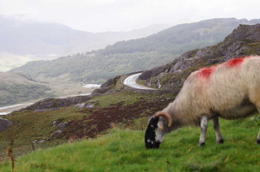
It is extremely narrow and winding, with many single-lane tunnels and switchbacks. Sheep wander the roads at will. Our rental car was wide and that made things even more challenging.
However, these are also fun conditions to drive in, especially when you can see there is no traffic in front of you and can rattle along safely.
Better get used to the curves, since it gets pretty tough on the Ring of Kerry. No chance of photo ops on the bad parts, either.
The Ring was crowded with cars, cyclists, hikers, and tour buses, even though this was low season (early September). I can only imagine what it would be like in the high season – we heard some horror stories from locals. Frankly I wouldn’t explore the area in July or August even though the weather would likely be better. The level of frustration would be too high.
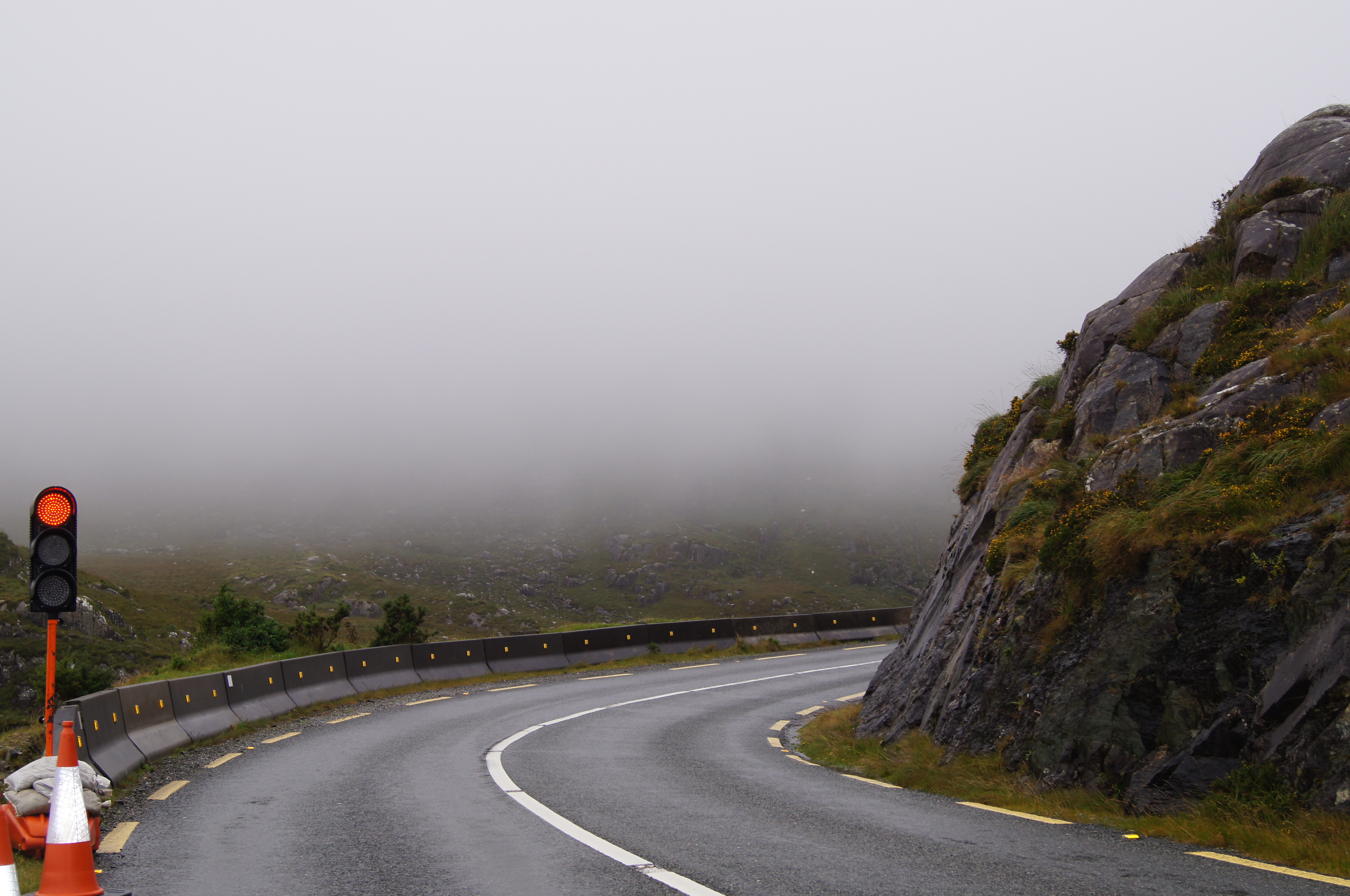
Roadworks and mist just make the driving that much more fun!
Given the driving challenges and the constant desire to pull over and take a photo, we found our progress around the Ring to be pretty slow. It is only about 100 miles (almost 200km). In Canada we would calculate that distance to take two or three hours, but each time we drove the Ring (three times in four days) it took us an average of about five hours, and was very tiring.
Still, spending time in such spectacular surroundings was rewarding.
Moll’s Gap
Moll’s Gap is a natural pit stop midway between Killarney and the coastal villages. Stellar views of bogs and distant mountains stretch away on both sides.
At the Gap there is an Avoca tourist shop with restrooms, and a large parking lot for coach buses. The hills are very high and winding, and we saw lots of cyclists cooling off after their exertions.
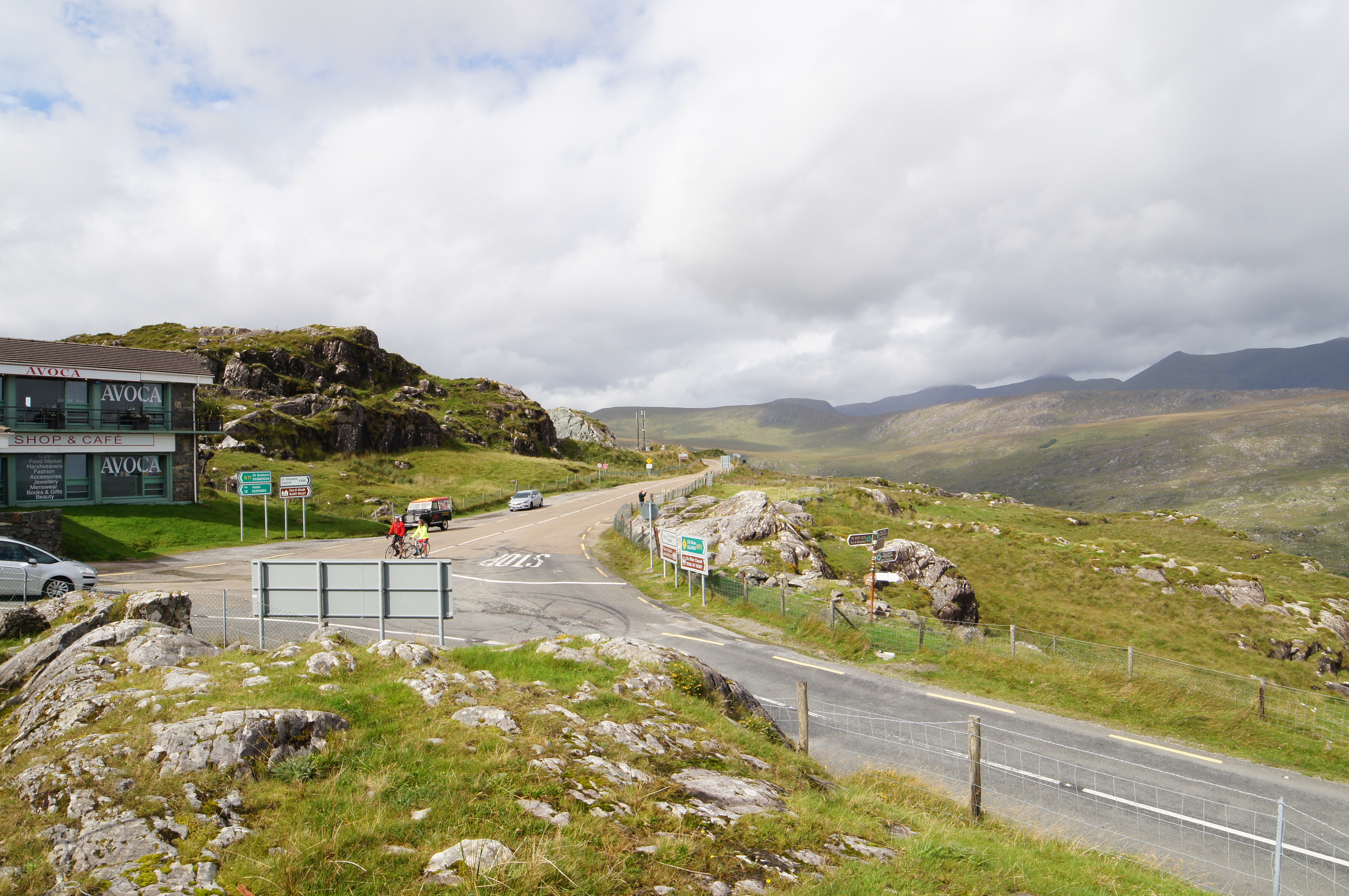
Moll’s Gap, a good rest stop on the tour of Ring of Kerry
Coincidentally, my Irish grandmother’s married name was Moll, so there was some family interest in stopping there.
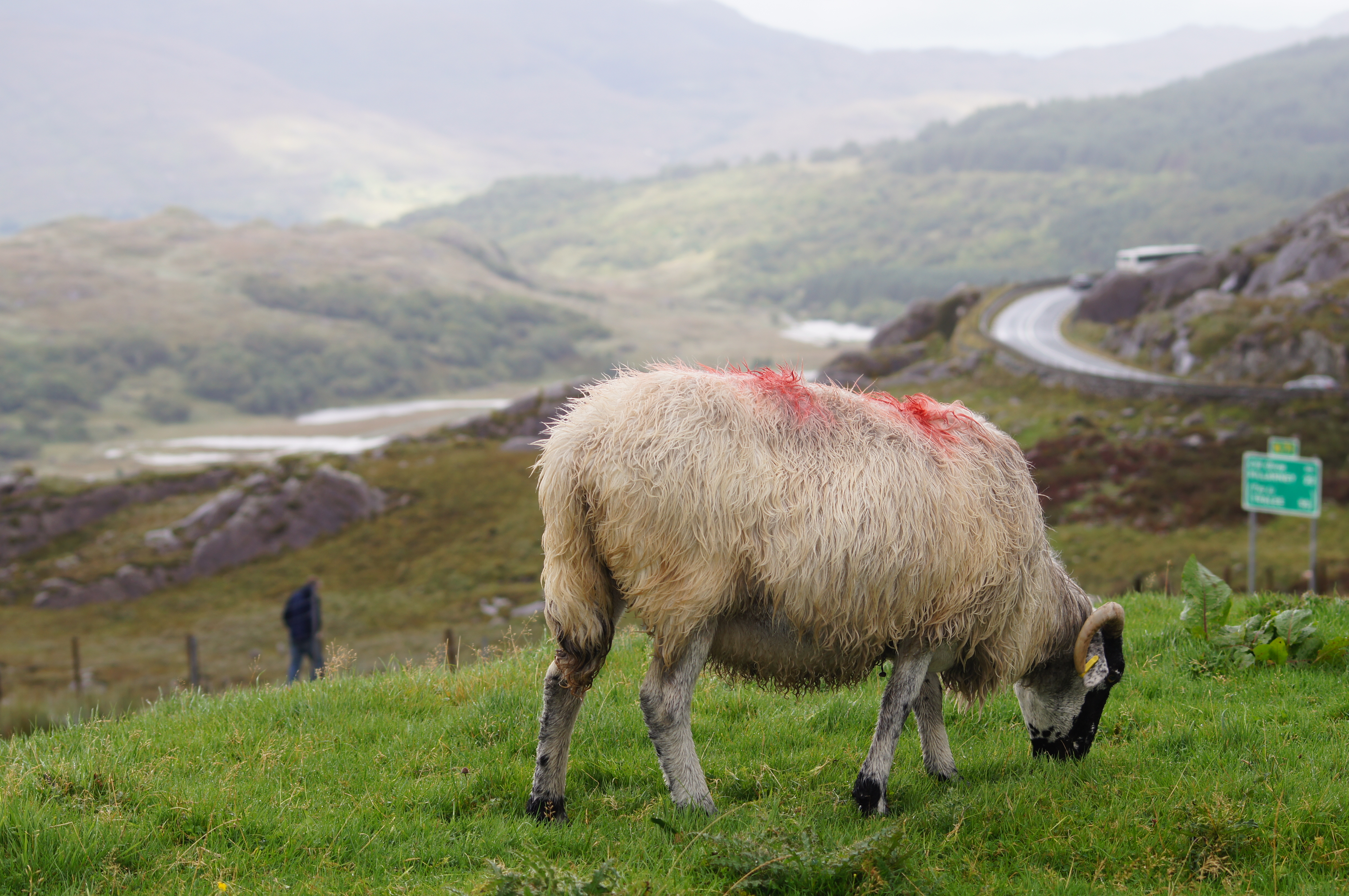
Sheep in the Mist
The Skelligs and Valentia Island
The first day after we drove through the Ring of Kerry we headed south-west to the Skellig peninsula, in the hopes of visiting Skellig Michael.
This rocky Atlantic island was originally colonized by Christian monks a thousand years ago. They carved a monastery, huts, and stairs out of the sheer rock, eking a living on the bleak and stormy promontory. The island is now home only to sea birds and seals, but it has recently become a famous film location because it appears at the end of the new Star Wars movie.
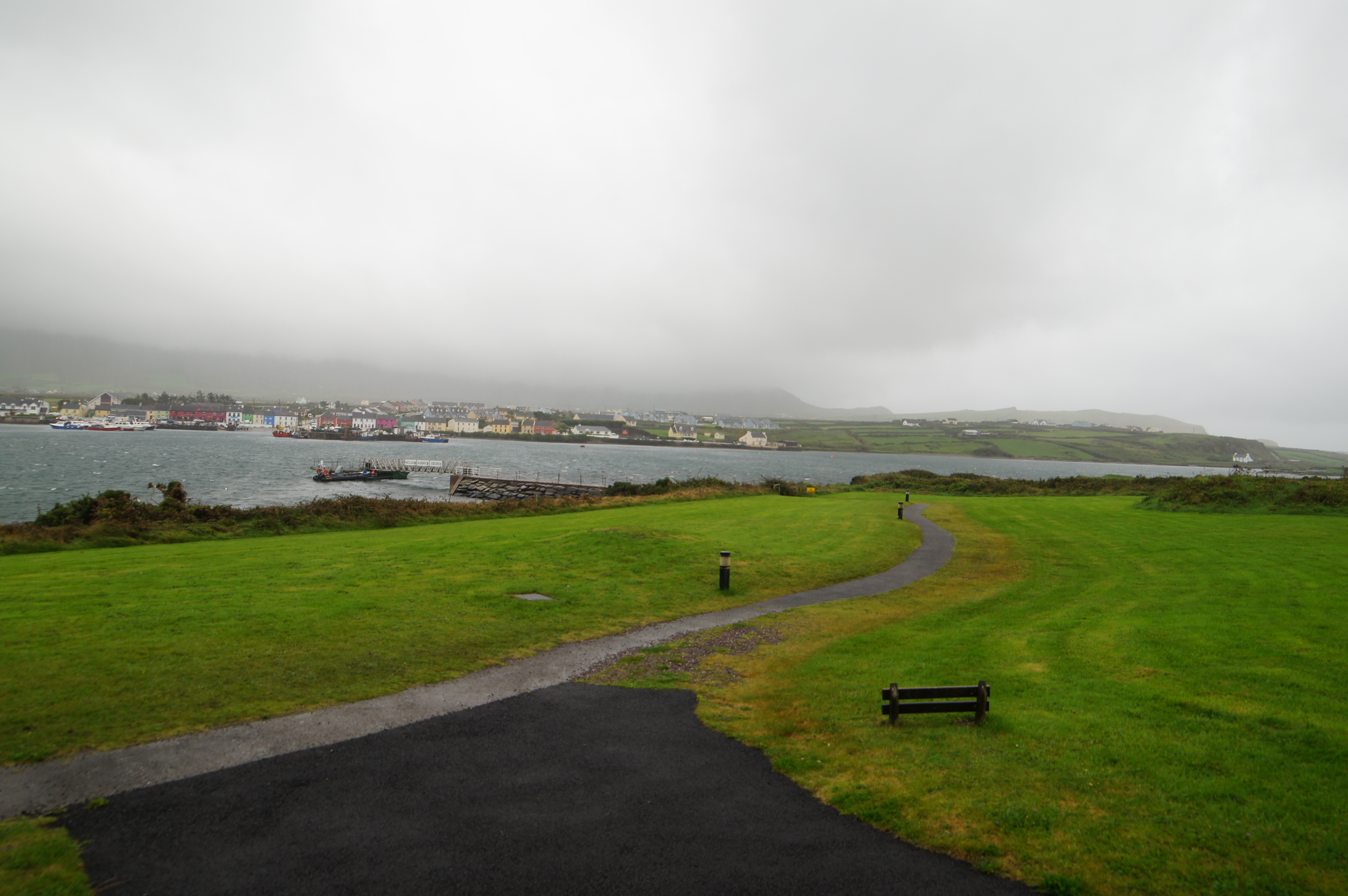
By the time we reached the village of Portmagee on Valentia Island, where the boat cruises are located, the weather was stormy with howling winds and there was no possibility of even taking a tour around the island, much less land on it.
Howling winds, rain and fog in Portmagee, as seen from the Skellig Experience centre
Instead we consoled ourselves with a visit to the Skellig Experience Centre. It has an exhibit of island artefacts, discusses bird- and marine-life, and screens a movie about the island’s history. The movie was the closest we got to viewing the island’s sensational scenery.
The centre also gave us a good overview of what the landing and climb would be like. In short: potentially dangerous and definitely uncomfortable.
To get to the island, visitors take an open-topped boat ride across the choppy Atlantic; there are no toilet facilities at any point on the trip; visitors debark from the wave-tossed boat one at a time by a narrow pier; the rough narrow stairs have few guard-rails; and tourists have died in the past by falling from the stairs (usually on descent). Therefore, proper planning and care is required to visit what looks like a very special but bleak destination.
Anyway I do plan to return and visit the island but given how dicey the weather is, I think I will have to organize a dedicated trip around it and make sure I have multiple opportunities to avoid winds or rain.
I was told by locals that some visitors spend years or even decades trying to visit Skellig Michael. From what I saw of the dramatic coastal weather I have little doubt that is true.
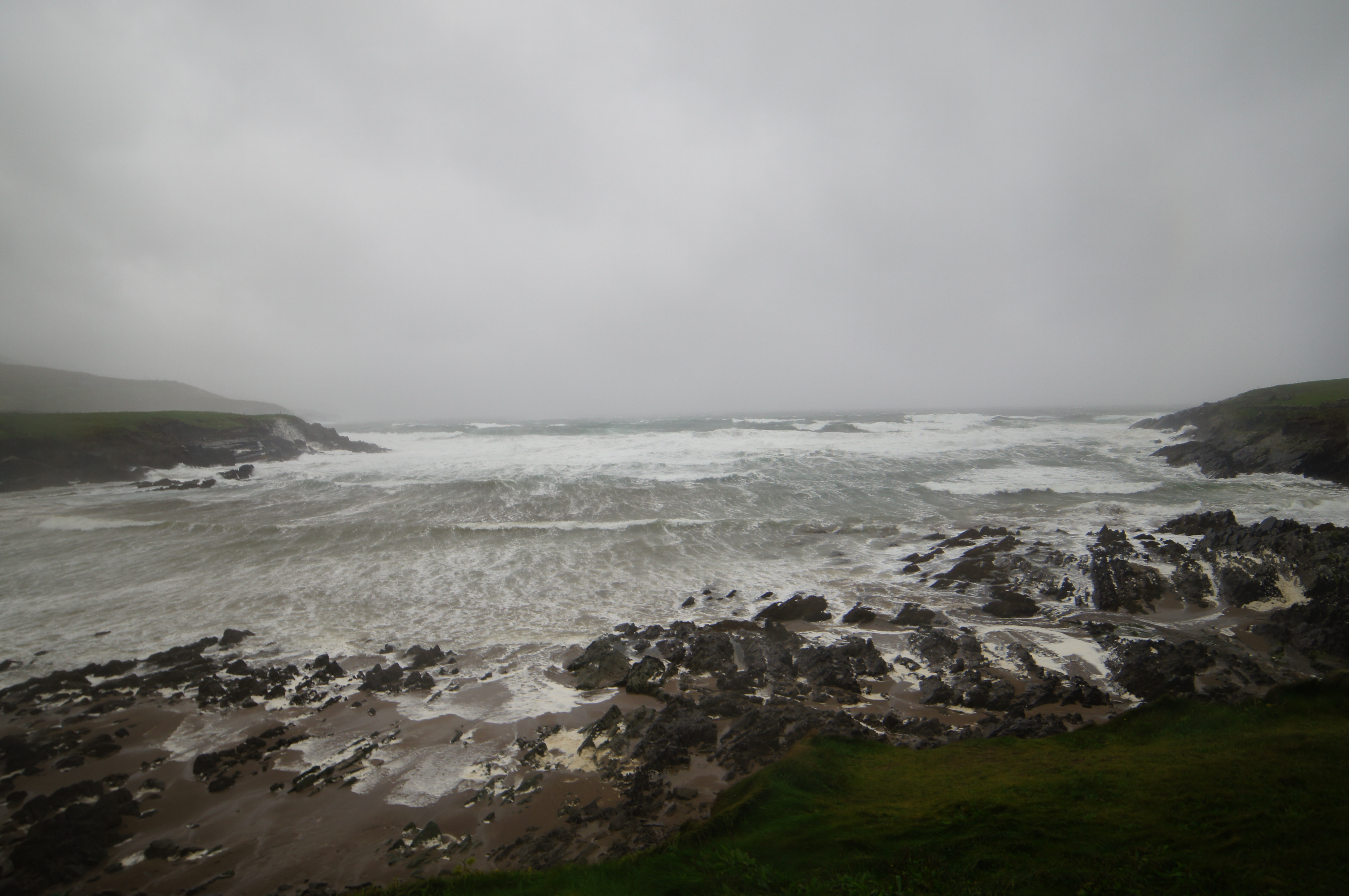
Rough weather in the Ring of Skellig means no boat trip to Skellig Michael